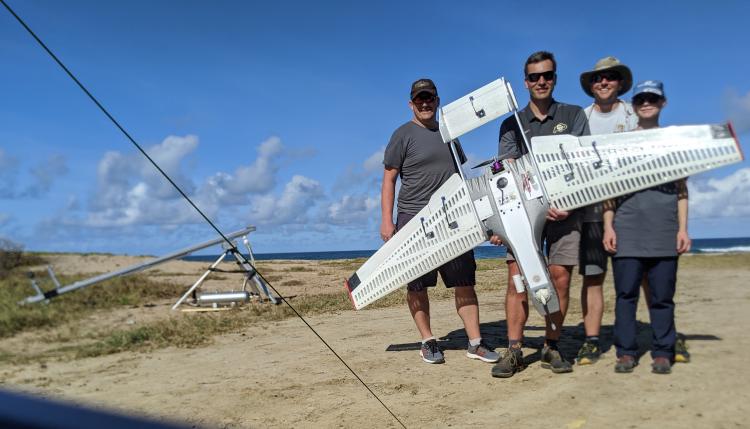
Steve Borenstein, Gijs de Boer, Michael Rhodes, and Radiance Calmer stand behind the RAAVEN with the launching system in the background

RAAVEN flying over the beach in Barbados
Researchers from CU Boulder recently spent four weeks flying drones off the coast of Barbados in hopes of advancing understanding and prediction of U.S. weather and climate.
Project ATOMIC – or Atlantic Tradewind Ocean-Atmosphere Mesoscale Interaction Campaign – is a partnership between CU Boulder, by the NOAA Climate Program Office Climate Variability and Predictability Program, NOAA UAS Program, as well as the NOAA Earth System Research Lab’s Physical Sciences Division, the Barbados Coastguard, NOAA's research ship Ronald H. Brown and WP-3D Orion "Hurricane Hunter" aircraft, and on land, NOAA Office of Marine and Aviation. Funding came from NOAA to conduct the research. The goal of the project is to collect data to improve the predictions of the climate off the coast of the ocean. The goal is to gather data on the clouds and land-sea interaction where the trade winds and ocean come together, in the tropics of the North Atlantic, east of Barbados.
Fieldwork ran from January 20 through February 17 and covered the North East side of Morgan Lewis Beach. The list of equipment for the project includes three unmanned aircraft systems known as the RAAVEN, 1 spare parts box, a launch kit that consisted of a rapid catapult and a bungee flat rail system. The 2020 CU team included three staff members, Steve Borenstein, Chris Choate, Michael Rhodes; two scientists, Gijs de Boer and Radiance Clamer; and Jonathan Hamilton a graduate student with RECUV.
The CU team was tasked with having three fully-equipped aircraft ready to fly in Barbados in one of the busiest holiday-packed months of the year. Our team navigated the skies through launching and directing the aircraft system down the coast and over the ocean to collect data that will further our knowledge of the ocean climate's shifting environment.
CU’s portion of the project is led by staff from the College of Engineering and Applied Science through the Integrated Remote and In Situ Sensing initiative. The team is responsible for piloting the three drones around the coast to measure temperature, turbulence, humidity and wind speeds. This was done through our IR sensors as well as a fine wire system with the help of our camera mounted to the drone to ensure that the operation ran smoothly. Drones are a critical component of the project because they sense data from inside the clouds – data that cannot be obtained without physically being there to take the measurements.
Research Gijs de Boer said, “The RAAVENs deployed during ATOMIC offer us unique perspectives on the atmospheric boundary layer over the tropical Atlantic Ocean. Having the ability to sample this key part of the atmosphere in detail using these robust and slow-moving platforms should offer revolutionary insight into the factors governing cloud cover in this climatically-important region of the Earth."