
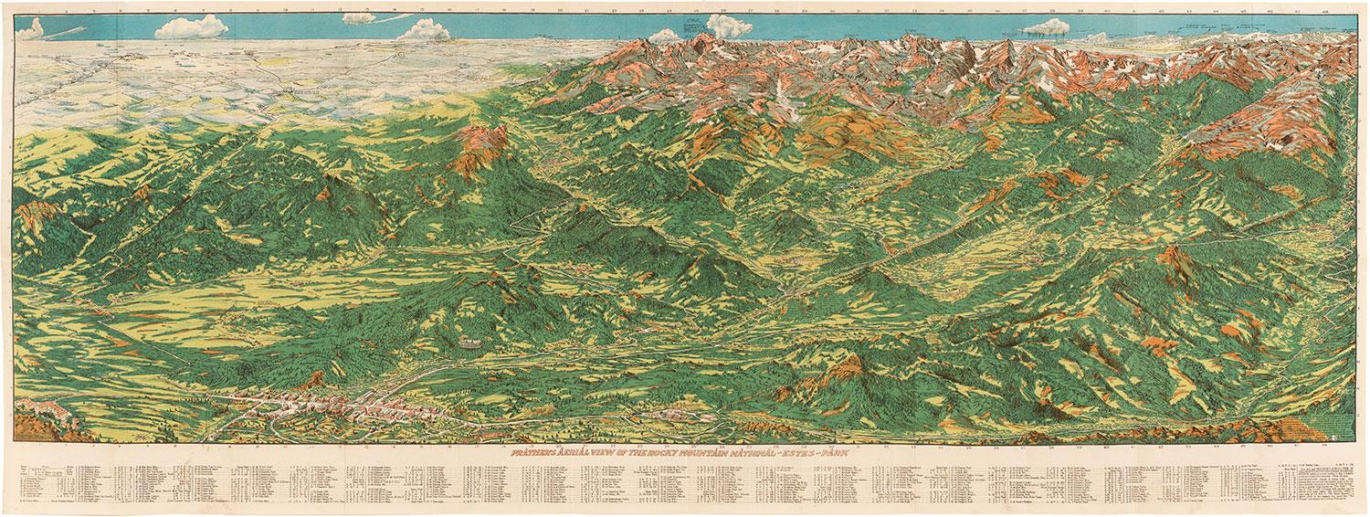


A Century of Views of Colorado: 1820-1920
See the drawings and maps of early Colorado settlers at the CU Boulder Earth Sciences & Map Library in the Benson Building.
The University Libraries’ exhibit, “A Century of Views of Colorado,” will be on display until May 25, 2018.
According to University Libraries, some of these rare drawings were created by artists accompanying government explorers to highlight economic and migration opportunities of the West to those living in the East. Others were commissioned by private companies.
On March 8, Antiques Roadshow print and map appraiser Christopher W. Lane discussed some of the more unusual maps at an event on campus.
Maps and illustrations courtesy University Libraries
Related Articles

10 Rare Works in Norlin Library
10 of the rarest works in Norlin Library's Special Collections & Archives exhibit. Read more

Campus Photo of the Week
With the end of the semester right around the corner, Norlin Library at CU is as busy as ever. Read more
