
PCDR
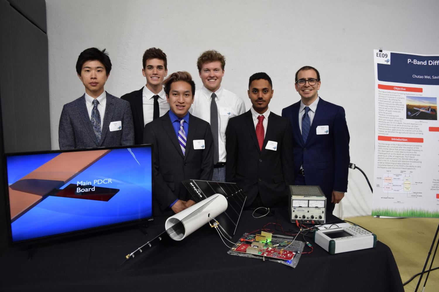
Team Beluga: Ameen Alshihab, Savio Tran, Hassan Aljishi, Chutao Wei, Josh Hirsh, Jared Marks
Sponsor: Professor Gasiewski, Center for Environmental Technology, working in conjunction with Black Swift Technologies and Orbital Micro Systems
Proper soil moisture facilitates nutrient uptake and root growth for plants, however, there lies immense difficulty in the ability to continually maintain such moisture. In fact, without a systematic method of facilitating irrigation, produce may struggle to thrive and potentially provoke widespread disease throughout crops. Thus, appropriately controlling moisture levels within the soil correlates directly to the success of crops and potential yield on a farm. In addition to agriculture, land management also requires a cheaper, more accurate approach to obtaining soil moisture measurements.
The problem at hand is currently covered using static sensors incapable of efficiently monitoring massive plots of land with high resolution. These ground sensors, such as tensiometers, require an extensive amount of maintenance, while low maintenance sensors, have very low accuracy which can heavily affect irrigation decisions. While maintenance may be conceivable for all technology, in ground sensors are merely capable of measuring very restricted radius’s, often maxing out at around three feet. Thus, with their high costs, only a limited number can be placed in a large area, in turn producing a very shoddy resolution of soil moisture. Therefore, static sensors with variable accuracy simply don’t provide data with sufficient resolution.
With the use of a radiometer integrated into an autonomous drone, a system capable of mapping moisture over vast fields of agriculture is achieved. This development opens new doors to economical irrigation sensing while providing critical data vital for attaining the greatest yields.
The end users for such advanced soil moisture sensing system includes farmers and agricultural corporations, where effective and efficient irrigation is required, while concurrently cutting unnecessary costs. Using an autonomous aircraft removes the need for intensive user interaction saving energy and labor for other tasks.
In addition to the agricultural industry, the PDCR can be used in park management and flood runoff, allowing for long term observation and data collection. This concept pairs perfectly with climate research as well, as there is a significant demand for land maps depicting changes in moisture levels over time.
Using radio frequencies to detect soil moisture offers many advantages over mapping techniques currently used. The sensor platform allows for high resolution and scalable moisture maps to be generated over any range of interest in near real time. With thorough data collection, exact areas can be pinpointed and proper irrigation or observation can be executed.
Future capabilities include a joint operation between the PDCR and irrigation systems, creating an autonomous agricultural acreage with minimal human upkeep. In comparison with traditional hard-wire moisture sensing networks, this product requires less maintenance and can be used in conjunction with other drones to cover large land areas producing moisture maps with resolution inconceivable up until now.