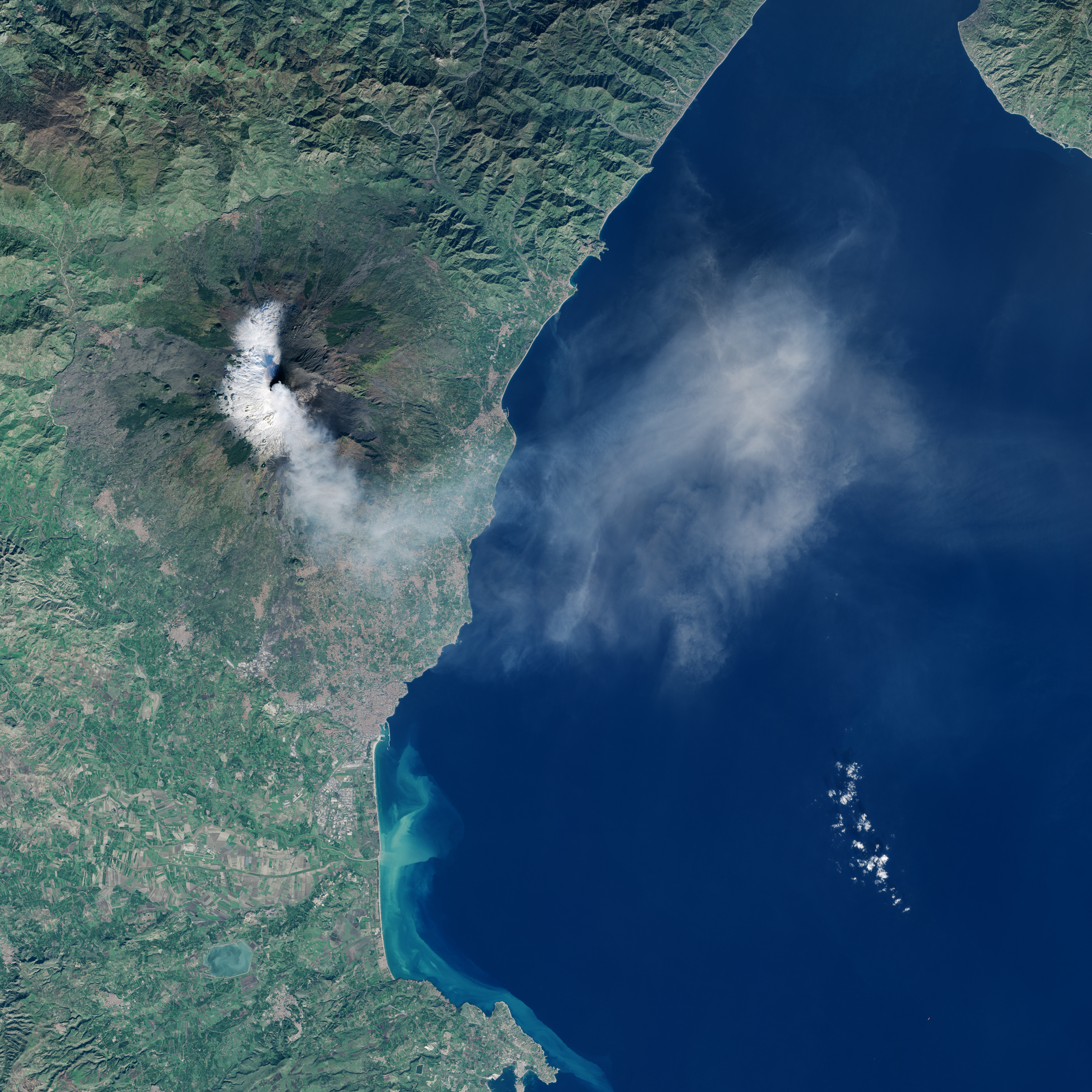
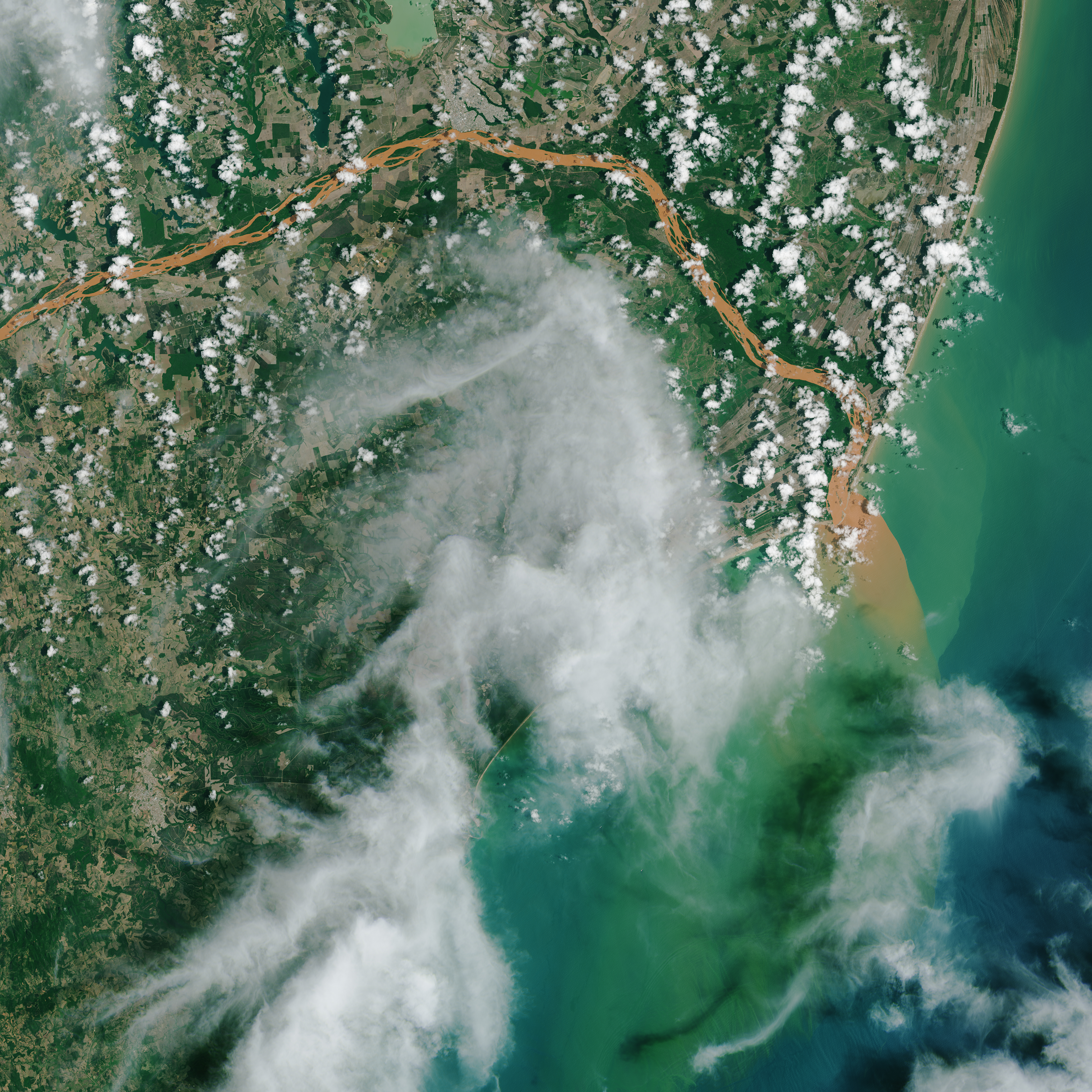
Space Exploration: Viewing There - Kristy TiampoSpace Exploration: Viewing There - Kristy Tiampo [video:https://youtu.be/9CTttSBdGK4] TimestampDescriptionAttributionCopyright Status0:00Pathway to Space Video OpenerCU Campus Aerial Photo: Glenn Asakawa; Graphics: Peter Cullum; Song: Garrett SayersCreated by Pathway to Space0:13 - end"Primary Background: Earth with black background created from various images from NOAA's GOES-East satellite"NASA/NOAA GOES ProjectPublic Domain0:53"NASA diagram with various satellites in their orbit with the earth on the right of the image"NASA’s Earth Observing Project Science OfficePublic Domain1:13"NASA's James Webb Space Telescope Mirrors"NASAPublic Domain1:25"Zoomed out photograph of the earth with many satellites in orbit"European Space AgencyPublic Domain1:50"Photograph of a working Engineer Nithin Abraham on the James Webb Telescope"NASA/Chris GunnPublic Domain1:55"Graphic/Photo of the ENVIST satellite orbiting earth"EADS AstriumPublic Domain2:13"Photograph of a large dust storm over Egypt taken by a satellite"Image Credit: Jeff Schmaltz, MODIS Land Rapid Response Team, NASA GSFCPublic Domain2:31"Video of winds taken by satellite in 2005"NASA/Goddard Space Flight Center Scientific Visualization StudioPublic Domain2:55"Black and white photograph of men holding the Explorer 1"NASAPublic Domain4:00"Satellite photo highlighting electromagnetic activity (red/blue photograph)"NASAPublic Domain4:43"Screenshot of a diagram outlining the electromagnetic spectrum (wavelength)"NASA Goddard Space Flight CenterPublic Domain5:31"Diagram that shows how passive satellites work"NASAPublic Domain6:01"Satellite photo of a volcano that is recording heat"NASAPublic Domain6:18"Diagram that shows how active satellites work"NASAPublic Domain6:47"Radar sensor satellite system (active satellite) (appears like an umbrella on a satellite)"NASAPublic Domain8:30"Movie demonstrating chlorophyll and sea surface temperature changes over time"Provided by Kristy TiampoUnknown10:48"Topographic photo of Boulder"Provided by Kristy TiampoUnknown11:57"Antarctica's topography"NASAPublic Domain12:59"Satellite photo demonstrating geometric resolution"Provided by Kristy TiampoUnknown13:20"Glacier landslide image from Taan Fjord"Provided by Kristy TiampoUnknown13:44"Landsat8 collecting data above earth's surface"NASA Goddard Space Flight CenterPublic Domain14:24"The Multi-angle Imaging Spectroradiometer (MISR) is an instrument on the Terra spacecraft, launched in 1999."NASAPublic Domain15:44"Video of the Landsat 8 satellite's data"NASAPublic Domain16:08"Satellite image of Mount Etna erupting"NASAPublic Domain16:27"Satellite image of Noor 1 in Morocco"NASAPublic Domain16:48"Landsat8 flood image"NASAPublic Domain17:17"SMAP radar image from March to April 2015."NASAPublic Domain17:36"ESA is developing a new family of missions called Sentinels specifically for the operational needs of the Copernicus program"European Space AgencyPublic Domain18:17"Sentinel 5 satellite carries the Tropospheric Ozone Monitoring Instrument, Tropomi, which is an advanced absorption spectrometer to provide data on atmospheric trace gases and aerosols linked to air quality and climate for Europe’s Global Monitoring for Environment and Security program"European Space AgencyPublic Domain18:33"Sentinel 6 satellite carries a radar altimeter to provide high-precision and timely observations of the topography of the global ocean."European Space AgencyPublic Domain18:52"Video displaying sea surface temperature"NASAPublic Domain19:12"Remote sensing salinity data video"NASAPublic Domain19:44"Video of Landsat satellite's data"NASAPublic Domain
