
Principals
Matthew Druckenmiller; Amanda Leon; Walt Meier; Twila Moon; Karl Rittger

Funding
National Aeronautics and Space Administration (NASA); National Oceanic and Atmospheric Administration (NOAA)
Collaboration + support
Cooperative Institute for Research in Environmental Sciences (CIRES); Institute for Alpine and Arctic Research (INSTAAR)
Learn more about this topic:
 National Snow and Ice Data Center monitors sea ice, tracks snow, examines Arctic conditions and informs global decision-makers
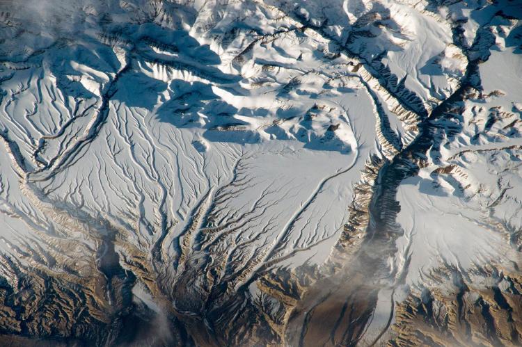
The frozen parts of the planet, known collectively as the cryosphere, are changing faster than any other on Earth because of climate change. Through a combination of scientific research and data management, the National Snow and Ice Data Center (NSIDC), part of the Cooperative Institute for Research in Environmental Sciences (CIRES), is working to understand this frozen realm. What is happening? Why are these changes taking place? How is society being affected?
Providing open data
Since 1993, NSIDC has worked with NASA to provide open data—from Earth-observing satellite missions, airborne campaigns and field observations—to the public via the NASA National Snow and Ice Data Center Distributed Active Archive Center (NSIDC DAAC). The Boulder-based NSIDC DAAC serves NASA’s mission to understand Earth and its response to natural and human-induced change. Scientists use these data to study frozen elements like snow cover and sea ice, as well as climate interactions. This year, for the seventh time, NASA selected the NSIDC DAAC to continue this work via a $68 million contract. Priority areas include providing expert stewardship of NASA cryospheric data, enabling a diverse science community, advancing open science and leveraging cloud computing technology.
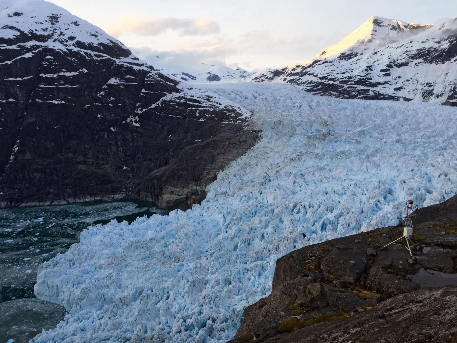
Automated weather station collects data near the LeConte Glacier in Alaska.
Monitoring Arctic sea ice
Arctic sea ice helps regulate Earth’s climate, influences global weather patterns and affects ocean circulations. As sea ice decreases, impacting the entire planet, NSIDC scientists observe and analyze sea ice conditions, the changes occurring and the influencing factors via the Arctic Sea Ice News & Analysis (ASINA), a NASA-funded website that provides daily data and monthly insights. While they monitor conditions throughout the year, an especially important indicator of climate change is the Arctic sea ice minimum extent, which happens at the end of the melt season in September. In 2022, Arctic sea ice extent tied for tenth lowest in the nearly 44-year satellite record. The last 16 years are the lowest 16 sea ice extents in the satellite record.
Tracking snow across the American West
In some western states, up to 75 percent of the water supply comes from snowmelt. It is imperative for water managers to understand where snow falls and accumulates, how much water is stored in snow and the timing of snowmelt. In collaboration with the Institute for Alpine and Arctic Research (INSTAAR), NSIDC tracks snow cover and snow water equivalent information along with snow albedo (the reflectivity of snow) and the impact of dust on snow’s energy balance for the western U.S. 2023 was a record-breaking snow year for the West, with snow-covered area and snow cover days hitting all-time highs in the 23 years of satellite observations.
The state of the Arctic
Since 2006, the National Oceanic and Atmospheric Administration (NOAA) has released an annual Arctic Report Card, a peer-reviewed publication on the state of the Arctic environmental system, its impacts on wildlife, and the consequences of rapid Arctic environmental change for people. Each year, NSIDC scientists contribute to the report card by serving as editors, authoring or co-authoring chapters, and contributing data and new research. One hundred forty-four scientists from 11 countries contributed to the 2022 report, which NSIDC’s Matthew Druckenmiller and Twila Moon co-edited.
The 2022 Arctic Report Card shared that the duration of snow cover is rapidly declining while rainfall is increasing, the last seven years in the Arctic have been the warmest on record, and commercial activities are increasing as sea ice melt opens up new shipping routes. The lives and cultures of Indigenous peoples who have lived in the region for millennia are being threatened as sea ice dwindles, causing coastlines to erode and hunting and travel to become more dangerous. The editors called for global action to address climate disruptions and to develop new forms of partnerships and information sharing, including between scientists and Indigenous knowledge-holders.
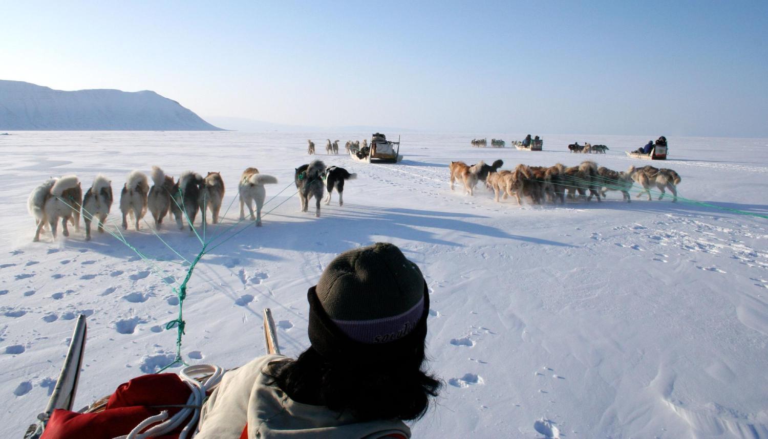
Photos: The NSIDC works to understand the frozen realm known as the cryosphere through a wide range of research activities. Dogsledding was an essential means of travel during the Siku-Inuit-Hila project in Greenland, while an automated weather station collects data near the LeConte Glacier in Alaska. Photos by: NASA (satellite); Twila Moon, NSIDC (glacier); Shari Fox, NSIDC (dogsledding).