
City flood protection project at CU Boulder South nears design milestone
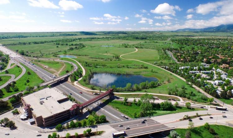
Photo courtesy of city of Boulder
City of Boulder staff engineers say they’re close to completing the 30% design phase of the South Boulder Creek Flood Mitigation Project, a milestone that will enable the city to begin the permitting process with a number of local, state and federal agencies.
City Council’s decision last fall to annex the CU Boulder South property enabled city staff to begin design in earnest for a project that will provide flood protection for 2,300 downstream residents in the “West Valley” area of the city—an area that saw severe flooding during the 2013 floods. Design and permitting is slated to continue into 2024, with construction set to begin that year and be completed in 2026.
City staff provided an update at Tuesday’s City Council meeting.
“It certainly is a complex process,” said Joe Taddeucci, director of public works for utilities at the city. “I’m happy to report that we’re still on track and moving forward.”
The South Boulder Creek Flood Mitigation Project will include construction of an earthen embankment at CU Boulder South and a floodwall along U.S. 36 that will detain floodwater and release it in a controlled way during a major flood event. The 30% design phase includes groundwater modeling, hydraulic modeling, civil design layout and geotechnical investigations of the site, detailing how the features of the project fit together.
At the completion of the 30% design phase, Taddeucci and Brandon Coleman, the city’s lead stormwater/flood engineer, told council they’ll be able to submit to the Army Corps of Engineers for an initial jurisdictional assessment that will set the stage for future permitting. Ultimately, the city will work with the United States Environmental Protection Agency, Federal Emergency Management Agency, U.S. Fish and Wildlife, Colorado Parks and Wildlife, Boulder County, the Colorado Department of Public Health and Environment, the Colorado Department of Transportation, Colorado Division on Water Resources and others to gain the approvals and stakeholder agreements necessary.
“The key council decisions really allowed us to stop spinning on alternatives and get started down the road of obtaining these permits and working on the design,” Taddeucci said, referring to annexation of CU Boulder South, as well as to City Council’s selection in 2020 of the Variant 1, 100-year flood mitigation concept.
CU Boulder South is a university-owned 308-acre parcel of land at the junction of Table Mesa Drive and U.S. 36. The annexation agreement approved in September provides numerous community benefits. In addition to the flood protection, it provides for the protection and restoration of critical riparian habitat and well-planned housing-centered development on a limited portion of the site.
As part of the annexation agreement, the university committed to transfer 155 acres of the site to the city, including 119 acres to be permanently preserved as city open space and the transfer of the needed water rights for habitat restoration and maintenance.
Once the flood protection project is complete, the university will be able to move forward with development of up to 129 acres of the site, with a predominant use of housing that will make a meaningful impact on the city’s housing shortage and allow more CU Boulder faculty, staff and non-freshman students to live in the city.